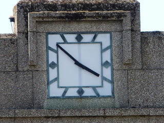
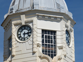
Get your walking shoes on as we are going for a tour of the outer perimeters of Southampton city centre.
The city was, and is still is, a major port. So off to the docks we go, and more specifically to Dock Gate 10 on Southern Road.
Dock Gate 10 marks on of the entrances to what is now Associated British Ports' Port of Southampton. There was a recent proposal by the company to remove this gate (and its sister Gate 8) as it restricts the height of vehicles that can pass into the murky depths of port-land. Thankfully these plans were defeated and the gate (the portal to the port) still stands.
It was built in 1933 or 1934. Further information can be found on the excellent The Beauty of Transport blog www.thebeautyoftransport.wordpress.com.
And the clock itself has now been restored - for many years it had no hands.
Dock Gate 8 is on Herbert Walker Avenue, and in overall design is the same as its sister, although omitting the words "Port of Southampton". Its size can be judged by the artic turning around in front of it (not incidentally because it was too big to get through, rather the driver was looking for somewhere to park up and have a rest).
The gate is right next to where the big liners now berth. Below you can just glimpse the Exploiter (sorry, Explorer) of the Seas, one of the new breed of architectural monstrosities on water - hence I couldn't be bothered to get a decent photo of it.
This is the other side of the gate - not surprisingly with no lettering, but with a clock face.
Hugging the shoreline, the next stop is the old Harbour Master's House.
The building is now a "gentleman's club", although I suspect not the sort of gentlemen that the Harbourmaster would have associated with.
Nice building, with a fantastic weather vane.
Around the corner on Terminus Terrace, is the old Terminus station. Similar to the Harbourmasters house, this building has now come somewhat more downmarket, housing a casino.
The station was opened on 10 June 1839, and closed to passengers on 5 September 1966.
The old trainshed can still be seen...
...as can the old roadway into the station.
St Mary's church occupies a plot of land that has been a religious site since the 7th century. The current building, with its massive 200 feet steeple, was consecrated as recently as 1956, a rebuilding of the World War II bomb-damaged church.
I tried for ages to get a picture of the clock through the branches of the tree which obscure its vantage onto St Mary Street, before realising that there were clear views of the clock faces on the other sides of the tower.
The north end of St Mary Street runs into Northam Road. This looks to be a run-down street which is trying very hard to go up-market again. My advice would be to invest in a statement clock, one that is more visually powerful than the example below.
And finally we end up to the north of the city centre, at Mount Pleasant school. It is somewhat surprising (but gratifying) to find such a large clock tower in what is an otherwise relatively unassuming school (built in 1898).


No comments:
Post a Comment